
January 10, 2016
Dry and cold the past week; no frogs. Today is a Northwestern anomaly; a beautiful, clear winter day, a picturesque time to mention and show an incongruous challenge our little frog pond faces. I gimped my way down to the highway, having tweaked my back yesterday at an ivy pulling event (I’d like to say I was pulling something serious out of the ground when I hurt it, but the truth is I was doing some light raking, turned a bit and wham! I think my belt was a notch too tight; the indignity of getting old!) Traffic was light down at the highway, so I crossed like a stooped salamander, carefully got down the bank, made for a log car with a good ladder (the siding full of a log train) and climbed over. Then down to the Multnomah Channel and this sign.

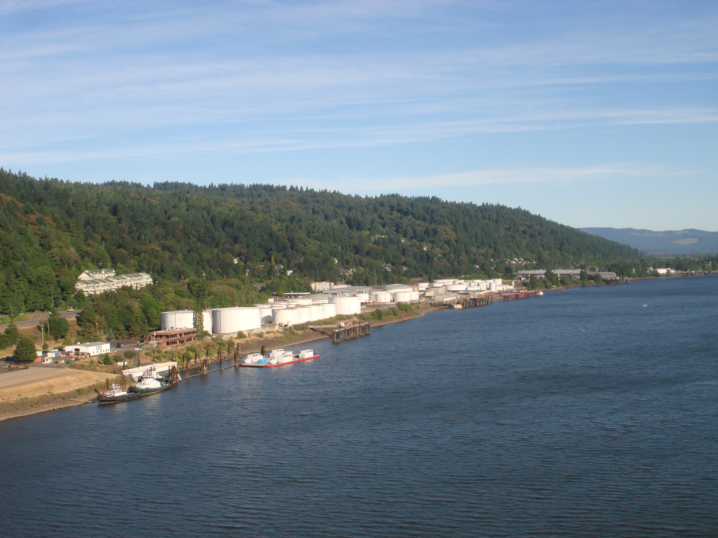
Over 75% of Oregon’s petroleum products are pumped down from Anacortes, Washington in this pipeline (actually four pipes), which goes under the Columbia, across the tip of Sauvie Island, under Multnomah Channel and under the frog pond, where it makes a hard left along the railroad tracks toward Linnton and all the tank farms. This photo is taken from the St Johns bridge and shows the beginning of the tank farms, the village of Linnton, mostly hidden in the hillside forest. The pond is located on the right edge of the picture.
This next photo was taken from behind the big sign, facing south, the pond in the distance, the first rise of the Tualatin Ridge (and Forest Park, home to these frogs) behind. The Harborton neighborhood is a hundred yards past the right edge of the photo.

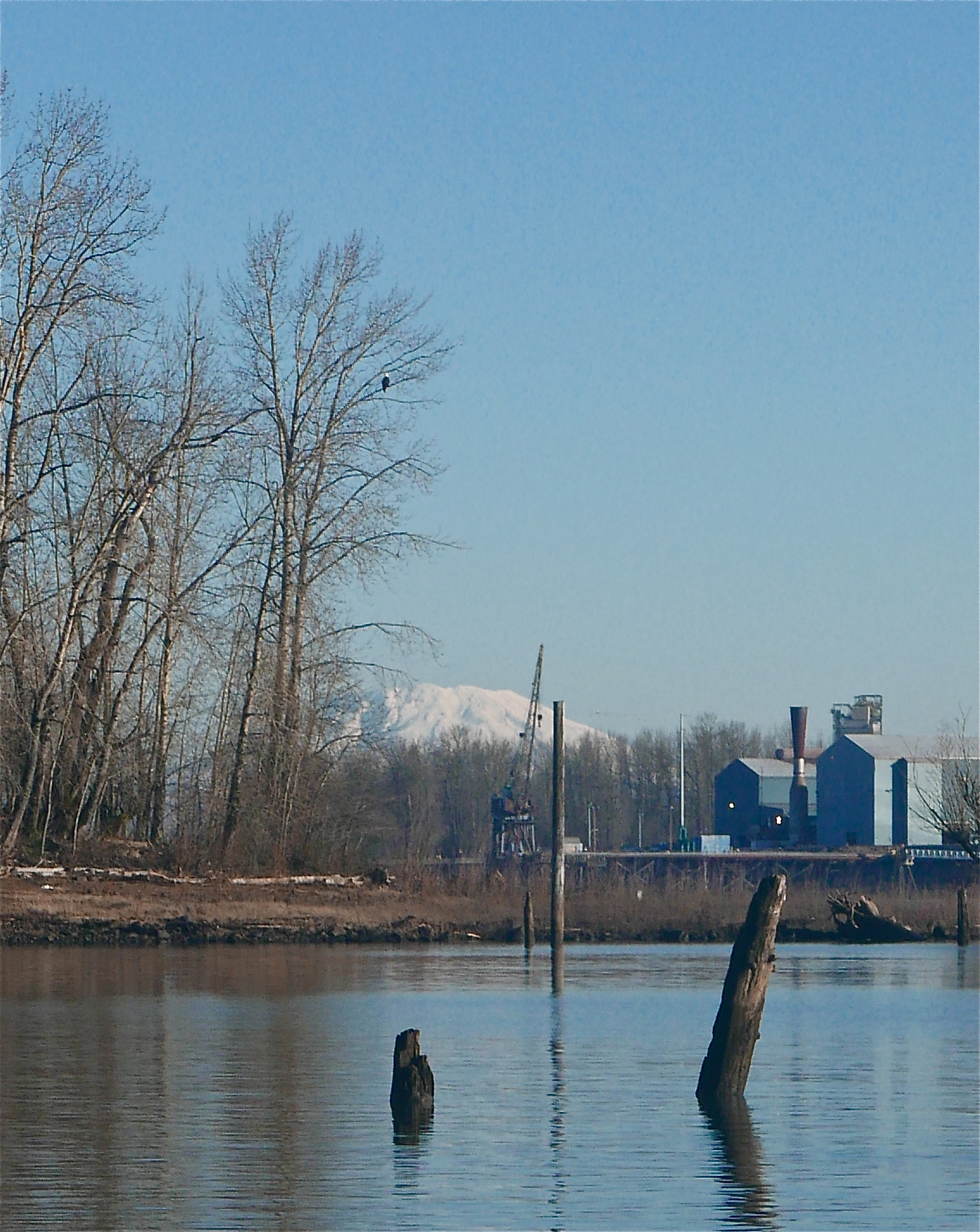
The photo below is of the tip of Sauvie Island, Multnomah Channel in the foreground (it forms the west side of the island), the blue building the Evraz Steel Mill across the Willamette River, Mt. St. Helens in the background, and one of a pair of Bald eagles who roost up in the park each night sitting in the tree.
The photo below faces north (as does the photo above), and shows the pond from one of the two frog release places. The pond has been mostly frozen this past week but yesterday the temperature reached 45 and only got to 33 last night, so the pond thawed by midmorning. The pipeline was built in the 1960s, almost thirty years before we realized the Northwest coast is subject to massive subduction earthquakes, of a magnitude of 8.5 to 9.5 and lasting two to five minutes. The last such quake was in 1700, and they occur every 300 years or so. Neither designed nor built with any earthquake in mind, the question is not if the pipeline will break in such an event, but where, and in how many places.
